Why networks matter
Rain, frost and soil moisture can change a lot over a few kilometres. A single site is great for the paddock it sits in, but it can't tell you whether the storm that missed you hit the block down the road, or how deep the break went across the district.
Put a group of sites on the same platform and that picture fills in. Growers see their own data alongside their neighbours'. Agronomists see every client in one place. And when the data's public, it's useful to people well beyond the farm gate — emergency services, plant breeders, researchers and the wider community.
Wimmera CMA Soil Moisture Probe Network
The Wimmera Catchment Management Authority runs a soil moisture probe network right across the Wimmera. In 2023 Wimmera CMA added 72 soil moisture probes and weather stations over roughly 30,000 square kilometres, funded through the Australian Government's Future Drought Fund.
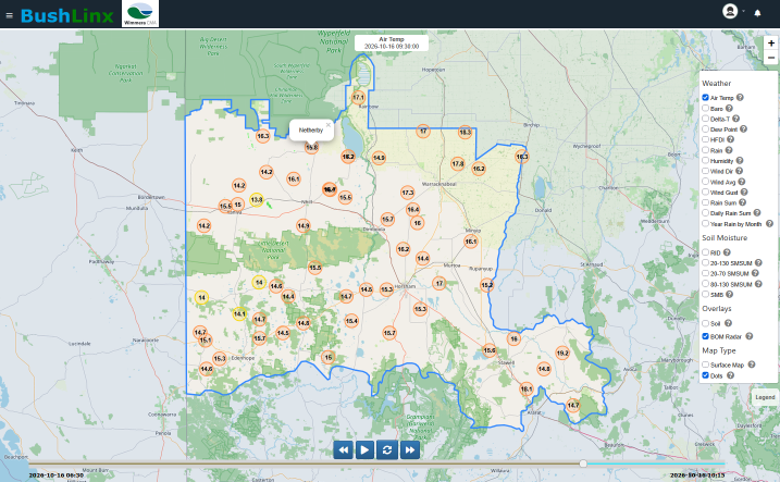
The portal farmers log into is built on our BushLinx® platform and hosted by us at data.integratedirrigation.com.au. Anyone can create a free account and see readings as they come in — every 15 minutes, from a phone or a computer.
What we did on it
The hardware in the network came from several manufacturers. We were the largest supplier of it, with our own BushLinx® gear in the ground, and we did all of the software and web platform work in house.
That's the part farmers don't see. Every manufacturer's equipment reports differently, so each one had to be imported, screened, ingested and calculated into the BushLinx® framework before any of it could sit side by side. We worked with the other manufacturers to pull their gear into line, so a farmer opening the portal gets one consistent set of readings and charts across the whole network — not a different experience depending on whose box is on the post.
What's on the portal
- Soil moisture through the upper and lower soil profile
- Air and soil temperature, humidity and dew point
- Rainfall, with monthly and annual rainfall tables
- Wind speed and direction
- Delta T for spray decisions
- Detailed frost information and the Harvest Fire Danger Index
- A site map, a live map across multiple measurements, and a dashboard for every station
Who uses it
Wimmera CMA pitches the network at dryland farmers, agronomists, plant breeders and emergency services. For growers, the big one is knowing what's actually sitting in the soil profile when deciding when — and what — to sow. For everyone else, it's a free, local, up-to-date picture of conditions across the region that didn't exist before.
Keeping it going and growing it
Wimmera CMA backs the portal with newsletters, case studies and webinars to help account holders get more out of the data.
Growing the network doesn't always mean new holes in the ground. Wimmera CMA has worked with us to find Wimmera farmers who already have our units installed, offering to cover their upgrade from 3G to 4G in exchange for adding their data to the portal until the end of the 2026 financial year. Existing on-farm sites get new life, and the regional picture gets more complete.
Private networks for farming groups
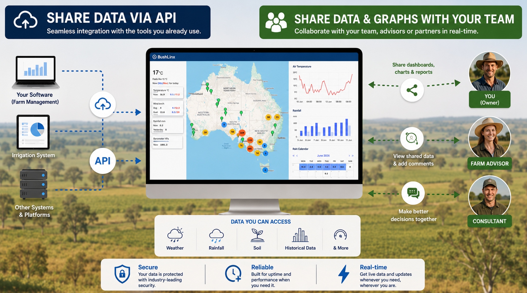
Not every network needs to be public. Grower groups, Landcare groups, a handful of neighbours, or a corporate with properties in different districts can share weather and soil moisture data across a defined group on BushLinx®.
- Each site owner stays in control of their own data and who sees it
- Members see the district picture alongside their own sites
- Agronomists and advisers can be given access across several members
- A site can be private, shared with a group, or public — and changed later
- Existing sites, and many other brands of logger and sensor, can often be brought into the network
Sharing is opt-in, not opt-out. Nothing is shared automatically.
Public networks for NRM bodies, councils and agencies
We also build networks for NRM bodies, catchment authorities, councils and government agencies that need to put data in front of the public. That usually means:
- A login page carrying the project's branding and acknowledging the funding body
- Free public accounts, so the community can get in without a sales conversation
- Live maps, station dashboards and rainfall tables that make sense to non-specialists
- Sites designed, installed and supported for the life of the project — and beyond it
- Historical data kept intact through hardware and connectivity upgrades
If you've got a project that needs weather or soil moisture data presented publicly, or a group that wants to start sharing, give us a call. We'll talk through what's worth measuring, where, and how people will actually use it.
Planning a network?
Talk to Tim about sites, connectivity, public access and funding.
Call Tim: 0459 231 028 Send an EnquiryWhere the Wimmera figures come from
- Wimmera CMA — Access the soil moisture probe portal ↗
- Australian Rural & Regional News — Wimmera expands soil moisture probe network (March 2023) ↗
- Wimmera Southern Mallee Development — Drought Resilience ↗
Integrated Irrigation (Orange Tulips Pty Ltd, ABN 25 142 893 614) is based in Penola, South Australia. BushLinx® is our farm monitoring brand.